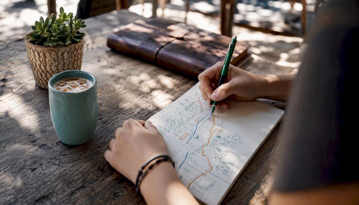
Mapping local experiences is one of the fastest ways to turn scattered neighborhood knowledge into trip decisions that actually hold up on the ground. Done right, it surfaces the places, rhythms, and social nodes that no algorithm surfaces on its own. SIPHER's participatory mapping research and Destlist's trip-planning practice both point to the same conclusion: a short pocket mapping exercise before or during a trip pays back in richer cultural choices, smarter routing, and connections you'd otherwise miss. Try it before your next day plan.
Here's what mapping local experiences gives you at a glance:
- Discovery: spots and rituals that don't appear on tourist maps
- Cultural depth: context that turns a visit into understanding
- Accessibility and safety flags: practical notes that protect your time
- Planning efficiency: a route that flows instead of backtracks
- Stronger local connections: people and places worth returning to
Key Takeaways
Mapping local experiences before or during a trip consistently surfaces places, rhythms, and social connections that no algorithm or guidebook reliably delivers.
| Point | Details |
|---|---|
| Start with a 20–30 min pocket map | Sketch nodes, add emotion codes, and pull one insight sentence before planning your day. |
| Layering beats single-source maps | Combine your route with local-platform signals to find spots algorithms overlook. |
| Ethics matter even for solo mappers | Ask consent before recording stories; avoid publishing identifiable details without permission. |
| Map outputs feed directly into planning | Sequence your top three nodes by geography and opening hours to build a day plan that flows. |
| Destlist converts map notes into itineraries | Submit photos and priority nodes to get a human-verified, ready-to-book plan within 24 hours. |
Table of Contents
- What "mapping local experiences" actually means
- The practical benefits of mapping local experiences
- Who benefits most from mapping community experiences
- A 20–30 minute pocket mapping exercise you can try today
- Which tools and formats actually work for mapping local experiences
- Ethics and participation: what responsible mapping requires
- How to turn your map into a concrete trip plan
- A practitioner's note on what mapping actually changes
- Destlist turns your pocket map into a ready-to-book itinerary
- Sources
What "mapping local experiences" actually means
The phrase covers several related practices, so it helps to know which one you're working with.
Participatory mapping is the broadest form. It invites people to locate meaningful places on a map and describe the emotions, interactions, and memories tied to them. The ASPECT participatory mapping guide shows how activities like drawing on floor plans or adding sticky notes to a base map produce rich qualitative evidence about use, emotion, and exclusion that a standard street map simply misses.
Experience maps (sometimes called journey maps) show what a person does, thinks, and feels across a sequence of moments. The Gov recommends collecting multiple users' event cards, staging the journey, and color-coding emotional highs and lows before consolidating into one view.
Experiential cartography goes further, deliberately including sensory and embodied perceptions. Research on mapping everyday urban political ecologies argues that adding smell, sound, and felt safety to a map creates richer representations of space than coordinates alone can capture.
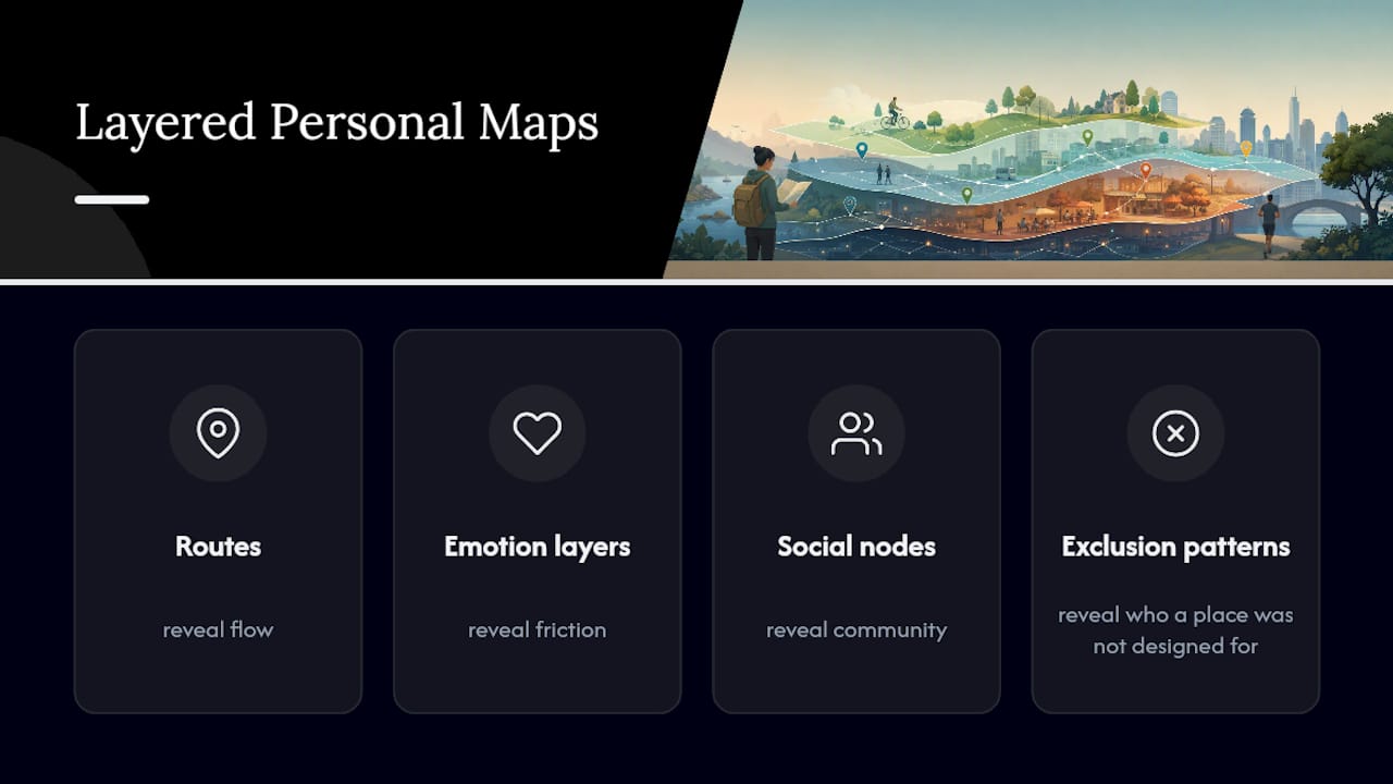
Layered personal maps combine your own route and notes with local-platform signals and conversation layers. Each form surfaces something different: routes reveal flow, emotion layers reveal friction, social nodes reveal community, and exclusion patterns reveal who a place was not designed for.
The practical benefits of mapping local experiences
Local knowledge transforms travel from checklist sightseeing into contextualized cultural understanding, as Adventure Vibes Magazine documents in its coverage of neighborhood rhythms and community-owned places.
- Discover local rhythms: morning markets, evening gathering spots, and weekly events that only locals know about
- Make better food and cultural choices: map nodes tied to local cuisine reveal where residents actually eat, not where tourists are directed
- Flag accessibility and safety issues: note uneven terrain, poorly lit streets, or areas that feel unwelcoming at certain hours
- Optimize routes and timing: cluster activities by geography and time of day to cut backtracking
- Build real connections: identifying social nodes (a corner café, a community garden) gives you a reason to return and a person to ask
SIPHER finding: Combining researcher-generated maps with community members' lived-experience maps surfaced missing nodes and added deeply personal perspectives that improved policy tools. The approach required long-term panel engagement — a reminder that the richest maps come from sustained relationships, not one-off interactions.
One honest limitation: any map reflects who made it. A solo traveler's pocket map skews toward their comfort zone. A community map skews toward whoever showed up to the workshop. Representation bias is real, and resource needs scale with ambition.
Who benefits most from mapping community experiences
Most travelers and locals fall into one of these groups:
- Slow travelers (stays of four or more days): mapping daily rituals and neighborhood anchors pays off quickly when you have time to revisit
- Families: accessibility notes, quiet spots, and kid-friendly timing windows are hard to find online and easy to map on arrival
- Local residents documenting change: a personal map built over months captures what a neighborhood used to feel like, which is data no app collects
- Event planners and community organizers: mapping foot-traffic flows and social nodes helps place activities where people already gather, as TSA Riley's people-and-place mapping work demonstrates
Should you map for this trip? Answer yes to two or more of these and it's worth the 20 minutes:
- Your stay is longer than a couple of nights
- You want to eat or shop where residents go, not tourists
- Accessibility or safety matters to your group
- You're visiting a neighborhood rather than a landmark
- You want something to remember beyond photos
A 20–30 minute pocket mapping exercise you can try today
This procedure adapts the GOV.UK experience map method to a solo traveler's context. See the travel experience mapping techniques list for variations.
- Print or sketch a base map of your target neighborhood (one side of a sheet of paper or a phone screenshot works fine).
- Set a 5-minute timer and mark every place you already know or want to visit. Don't filter yet.
- Add emotion stickers or color codes: green for "excited," yellow for "curious," red for "uncertain." Be honest about the red ones.
- Draw your likely route between the marks. Note where it backtracks or crosses itself.
- Write one word next to each node: the feeling, the food, the person, or the question you have about that place.
- Identify your top three nodes by circling the ones that combine high emotion with practical value (food, rest, cultural depth).
- Pull one insight from the map and write it as a single sentence: "I'll start at the morning market before 9 AM because that's when the vendors are still setting up."
| Step | Time | Materials |
|---|---|---|
| Sketch base map | 3 min | Paper, pen, or phone screenshot |
| Mark known/wanted places | 5 min | Colored pens or phone notes |
| Add emotion codes | 5 min | Highlighters or emoji in notes |
| Draw route and note friction | 5 min | Same pen |
| Label each node | 5 min | One word per place |
| Prioritize top three | 3 min | Circle or star |
| Write one insight sentence | 4 min | Notes app or margin |
Which tools and formats actually work for mapping local experiences
The right format depends on how long you're staying and how much you want to share the output.
- Paper and pen: fastest to start, zero battery anxiety, easy to annotate in the field. Hard to share and impossible to layer with digital data.
- Phone camera plus notes: geotagged photos clustered into stops, matched with local-rating sources, expose the gap between "popular" and "worth it" — a technique Yair Titelboim documents as a practical counter to algorithmic tourism.
- Simple mapping apps (Google My Maps, Felt, Mapbox): add layers, share with travel companions, and import into planning tools. Learning curve of 15–20 minutes.
- Layered spreadsheets: a table with columns for place name, category, emotion score, and opening hours works well for planners who prefer text over visuals. See map-based travel planning for how to organize daily routes this way.
| Format | Ease | Speed | Data richness | Shareable |
|---|---|---|---|---|
| Analogue (paper/pen) | High | Fast | Low | No |
| Hybrid (photos + notes) | Medium | Medium | Medium | Partially |
| Digital (mapping app) | Medium | Slower start | High | Yes |
Ethics and participation: what responsible mapping requires
Extractive mapping — collecting people's stories without giving them meaningful control — is a real risk, especially for travelers in communities they're passing through. SIPHER's work makes the point plainly: short encounters can be extractive when participants haven't had time to learn the mapping language or understand how their input will be used.
Practical ethical checklist:
- Ask before you record: get verbal or written consent before noting a person's story or photographing their space
- Explain the purpose: tell people what the map is for, even if it's just your own trip planning
- Protect privacy: don't publish maps with identifiable personal details without permission
- Avoid tokenism: one local contact doesn't represent a whole neighborhood; seek multiple perspectives
- Compensate fairly: if you're running a workshop or structured session, pay participants for their time
Pro Tip: Combine composite narratives (patterns across several conversations) with individual consent to reduce the burden on any one person while still preserving authentic voice in your map.
Question design matters too. Research on QR-coded public maps shows that different prompts produce very different response quality, and poorly designed questions reduce the rate at which contributors return to add more.
How to turn your map into a concrete trip plan
Once your pocket map exists, the translation to a day plan takes about ten minutes. The Interaction Design Foundation's experience mapping framework offers a useful analogy: identify touchpoints, flag emotional friction, and prioritize interventions. Applied to travel, that means:
- Extract themes: group your nodes by type (food, culture, rest, transit) and note which type dominates
- Prioritize nodes: your top three circled spots from the exercise become the anchors of the day
- Optimize route and timing: sequence anchors by geography and opening hours, not by excitement level
- Check accessibility and local schedules: confirm that your first stop is actually open when you plan to arrive
- Share with local businesses or cultural organizations: a quick message to a market vendor or community center often yields a schedule correction or an invitation you wouldn't have found otherwise
Example one-day plan built from a pocket map:
- 7:30 AM: Morning market (top-priority node, emotion: excited, opens at 7 AM)
- 11:00 AM: Neighborhood bakery two blocks from the market (secondary node, noted by a local contact)
- 6:00 PM: Community garden gathering (social node, flagged as "uncertain" on the map — confirmed open via a quick message)
For experiential travel planning that goes beyond a single day, the same logic scales: map first, then sequence.
A practitioner's note on what mapping actually changes
The conventional wisdom treats mapping as a planning tool. That's true, but it undersells what actually happens when you commit to drawing a neighborhood before you walk it.
A pocket map forces a decision before you arrive: what matters enough to mark? That act of prioritization changes how you move through a place. You stop scanning for the next thing and start noticing whether the thing in front of you matches what you expected. The contrast between expectation and reality is where the most interesting travel happens.
One experiment worth trying: map a neighborhood alone, then walk it with someone who lives there and compare what each of you marked. The differences are rarely about facts. They're about what each person considers worth noting at all. That comparison, more than any single insight, is why mapping community experiences has value beyond logistics.
Destlist's custom itinerary service is a practical next step: submit your pocket map notes and photos, and a human curator turns them into a sequenced, bookable plan.
Destlist turns your pocket map into a ready-to-book itinerary
Your pocket map is the raw material. Destlist is where it becomes a plan you can actually use.
Submit your map notes, photos, and priority nodes through Destlist's custom travel itinerary form, and a human-verified curator sequences them into a day-by-day itinerary with flights, hotels, walking times, and weather alerts included. The turnaround is 24 hours. You keep the cultural depth your map captured; Destlist handles the logistics that would otherwise take hours to sort. For travelers who want the discovery without the spreadsheet, that's the practical next step.
Sources
- Stewart-etal-IJSRM-2026-Prototyping-a-tool-to-layer-lived-experience-narratives.pdf
- Gov
- Deborah Ralls - Participatory Mapping guide (ASPECT)
- Customer experience mapping - Interaction Design Foundation
- Mapping everyday urban political ecologies: experiential cartography